Template Output Format
JSON-LD
In order to obtain a json-ld output format, request’s media type must be specified as “application/ld+json”. From Geoserver UI it is possible to have a preview of the format by choosing JSON-LD format by the layer preview page.
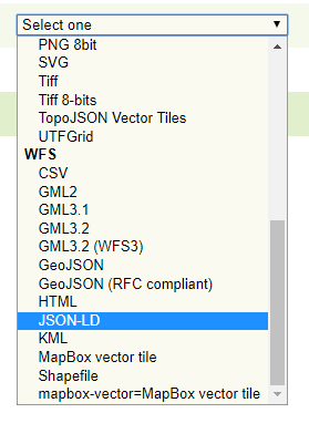
Dropdown menu in Layer preview page.
If OGC Feature API extension is enabled the output format is available from the collection page as well.
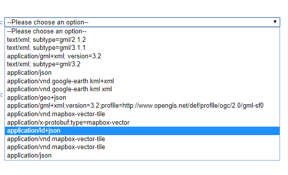
Dropdown menu in OGC Feature API collection page.
The output, given the template files showed in the configuration section, will look, in the json-ld case, like
{
  "@context": {
      "gsp": "http://www.opengis.net/ont/geosparql#",
      "sf": "http://www.opengis.net/ont/sf#",
      "schema": "https://schema.org/",
      "dc": "http://purl.org/dc/terms/",
      "Feature": "gsp:Feature",
      "FeatureCollection": "schema:Collection",
      "Point": "sf:Point",
      "wkt": "gsp:asWKT",
      "features": {
          "@container": "@set",
          "@id": "schema:hasPart"
      },
      "geometry": "sf:geometry",
      "description": "dc:description",
      "title": "dc:title",
      "name": "schema:name"
  },
  "type": "FeatureCollection",
  "features": [
      {
          "@id": "mf2",
          "@type": [
              "Feature",
              "gsml:MappedFeature",
              "http://vocabulary.odm2.org/samplingfeaturetype/mappedFeature"
          ],
          "name": "MERCIA MUDSTONE GROUP",
          "gsml:positionalAccuracy": {
              "value": "100.0"
          },
          "gsml:GeologicUnit": {
              "@id": "gu.25678",
              "description": "Olivine basalt, tuff, microgabbro, minor sedimentary rocks",
              "gsml:geologicUnitType": "urn:ogc:def:nil:OGC::unknown",
              "gsml:composition": [
                  {
                      "gsml:compositionPart": [
                          {
                              "gsml:role": {
                                  "value": "interbedded component",
                                  "@codeSpace": "urn:cgi:classi..."
                              },
                              "proportion": {
                                  "@dataType": "CGI_ValueProperty",
                                  "CGI_TermValue": {
                                      "@dataType": "CGI_TermValue",
                                      "value": {
                                          "value": "significant",
                                          "@codeSpace": "some:uri"
                                      }
                                  }
                              },
                              "lithology": [
                                  {
                                      "@id": "cc.3",
                                      "name": {
                                          "value": "name_cc_3",
                                          "@lang": "en"
                                      },
                                      "vocabulary": {
                                          "@href": "urn:ogc:def:nil:OGC::missing"
                                      }
                                  }
                              ]
                          }
                      ]
                  },
                  {
                      "gsml:compositionPart": [
                          {
                              "gsml:role": {
                                  "value": "interbedded component",
                                  "@codeSpace": "urn:cgi:class..."
                              },
                              "proportion": {
                                  "@dataType": "CGI_ValueProperty",
                                  "CGI_TermValue": {
                                      "@dataType": "CGI_TermValue",
                                      "value": {
                                          "value": "minor",
                                          "@codeSpace": "some:uri"
                                      }
                                  }
                              },
                              "lithology": [
                                  {
                                      "@id": "cc.4",
                                      "name": {
                                          "value": "name_cc_4",
                                          "@lang": "en"
                                      },
                                      "vocabulary": {
                                          "@href": "urn:ogc:def:nil:OGC::missing"
                                      }
                                  }
                              ]
                          }
                      ]
                  }
              ],
              "geometry": {
                  "@type": "Polygon",
                  "wkt": "POLYGON ((52.5 -1.3, 52.6 -1.3, 52.6 -1.2,...))"
              }
          }
      }
  ]
  }
JSON-LD Validation
The plugin provides a validation for the json-ld output against the @context defined in the template. It is possible to require it by specifying a new query parameter in the request: validation=true.
The validation takes advantage form the json-ld api and performes the following steps:
the expansion algorithm is executed against the json-ld output, expanding each features’ attribute name to IRIs, removing those with no reference in the
@contextand the@contextitself;the compaction algorithm is then executed on the expansion result, putting back the
@contextand shortens to the terms the expanded attribute names as in the original output;finally the result of the compaction process is compared to the original json-ld and if some attributes are missing it means that they were not referenced in the
@context. An exception is thrown with a message pointing to the missing attributes.
GEOJSON
The following is instead a GeoJSON output format, give the template showed in the configuration section.
 {
  "type":"FeatureCollection",
  "features":[
     {
        "@id":"mf4",
        "@type":[
           "Feature",
           "gsml:MappedFeature",
           "http://vocabulary.odm2.org/samplingfeaturetype/mappedFeature"
        ],
        "name":"MURRADUC BASALT",
        "gsml:positionalAccuracy":{
           "type":"gsml:CGI_NumericValue",
           "value":120.0
        },
        "gsml:GeologicUnit":{
           "@id":"gu.25682",
           "description":"Olivine basalt",
           "gsml:geologicUnitType":"urn:ogc:def:nil:OGC::unknown",
           "gsml:composition":[
              {
                 "gsml:compositionPart":[
                    {
                       "gsml:role":{
                          "value":"RoleValue: interbedded component",
                          "@codeSpace":"urn:cgi:classifierScheme:Example:CompositionPartRole"
                       },
                       "proportion":{
                          "@dataType":"CGI_ValueProperty",
                          "CGI_TermValue":{
                             "@dataType":"CGI_TermValue",
                             "value":{
                                "value":"significant",
                                "@codeSpace":"some:uri"
                             }
                          }
                       },
                       "lithology":[
                          {
                             "@id":"cc.1",
                             "name":{
                                "value":[
                                   "name_a",
                                   "name_b",
                                   "name_c"
                                ],
                                "@lang":"en"
                             },
                             "vocabulary":{
                                "@href":"urn:ogc:def:nil:OGC::missing"
                             }
                          },
                          {
                             "@id":"cc.2",
                             "name":{
                                "value":"name_2",
                                "@lang":"en"
                             },
                             "vocabulary":{
                                "@href":"urn:ogc:def:nil:OGC::missing"
                             }
                          }
                       ]
                    }
                 ]
              }
           ]
        },
        "geometry":{
           "type":"Polygon",
           "coordinates":[
              [
                 [
                    -1.3,
                    52.5
                 ],
                 [
                    -1.3,
                    52.6
                 ],
                 [
                    -1.2,
                    52.6
                 ],
                 [
                    -1.2,
                    52.5
                 ],
                 [
                    -1.3,
                    52.5
                 ]
              ]
           ]
        }
     }
  ]
}
While by using the flat_output VendorOption the output will be:
 {
  "type":"FeatureCollection",
  "features":[
     {
        "@id":"mf4",
        "geometry":{
           "type":"Polygon",
           "coordinates":[
              [
                 [
                    52.5,
                    -1.3
                 ],
                 [
                    52.6,
                    -1.3
                 ],
                 [
                    52.6,
                    -1.2
                 ],
                 [
                    52.5,
                    -1.2
                 ],
                 [
                    52.5,
                    -1.3
                 ]
              ]
           ]
        },
        "properties":{
           "name":"FeatureName: MURRADUC BASALT",
           "gsml:GeologicUnit_description":"Olivine basalt",
           "gsml:GeologicUnit_gsml:geologicUnitType":"urn:ogc:def:nil:OGC::unknown",
           "gsml:GeologicUnit_gsml:composition_gsml:compositionPart_gsml:role_value":"FeatureName: interbedded component",
           "gsml:GeologicUnit_gsml:composition_gsml:compositionPart_gsml:role_@codeSpace":"urn:cgi:classifierScheme:Example:CompositionPartRole",
           "gsml:GeologicUnit_gsml:composition_gsml:compositionPart_proportion_@dataType":"CGI_ValueProperty",
           "gsml:GeologicUnit_gsml:composition_gsml:compositionPart_proportion_CGI-TermValue_@dataType":"CGI_TermValue",
           "gsml:GeologicUnit_gsml:composition_gsml:compositionPart_proportion_CGI-TermValue_value":"significant",
           "gsml:GeologicUnit_gsml:composition_gsml:compositionPart_lithology_1_name_1":"name_a",
           "gsml:GeologicUnit_gsml:composition_gsml:compositionPart_lithology_1_name_2":"name_b",
           "gsml:GeologicUnit_gsml:composition_gsml:compositionPart_lithology_1_name_3":"name_c",
           "gsml:GeologicUnit_gsml:composition_gsml:compositionPart_lithology_1_vocabulary":"@href:urn:ogc:def:nil:OGC::missing",
           "gsml:GeologicUnit_gsml:composition_gsml:compositionPart_lithology_2_name":"name_2",
           "gsml:GeologicUnit_gsml:composition_gsml:compositionPart_lithology_2_vocabulary":"@href:urn:ogc:def:nil:OGC::missing"
        }
     }
  ]
}