Welcome
The Welcome Page lists the web services published by GeoServer for mapping, data access and processing.
Note
The workspace and layer selectors migth take a lot of time to fill up against large catalogs. Because of this, GeoServer tries to limit the time taken to fill them (by default, 5 seconds), and the amount of items in them (by default, 1000), and will fall back on simple text fields if the time limit is reached. In some situations, that won’t be enough and the page might get stuck anyways. The following variables can be used to tweak the behavior:
GeoServerHomePage.selectionMode: can be set totextto always use simple text fields,dropdownto always use dropdowns, orautoto use the default automatic behavior.GeoServerHomePage.selectionTimeout: the time limit in milliseconds, defaults to 5000.GeoServerHomePage.selectionMaxItems: the maximum number of items to show in the dropdowns, defaults to 1000.
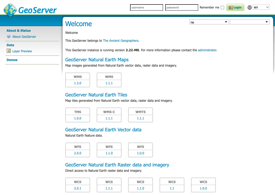
Web Services
The welcome page lists the global web services (accessing the complete list of layers).
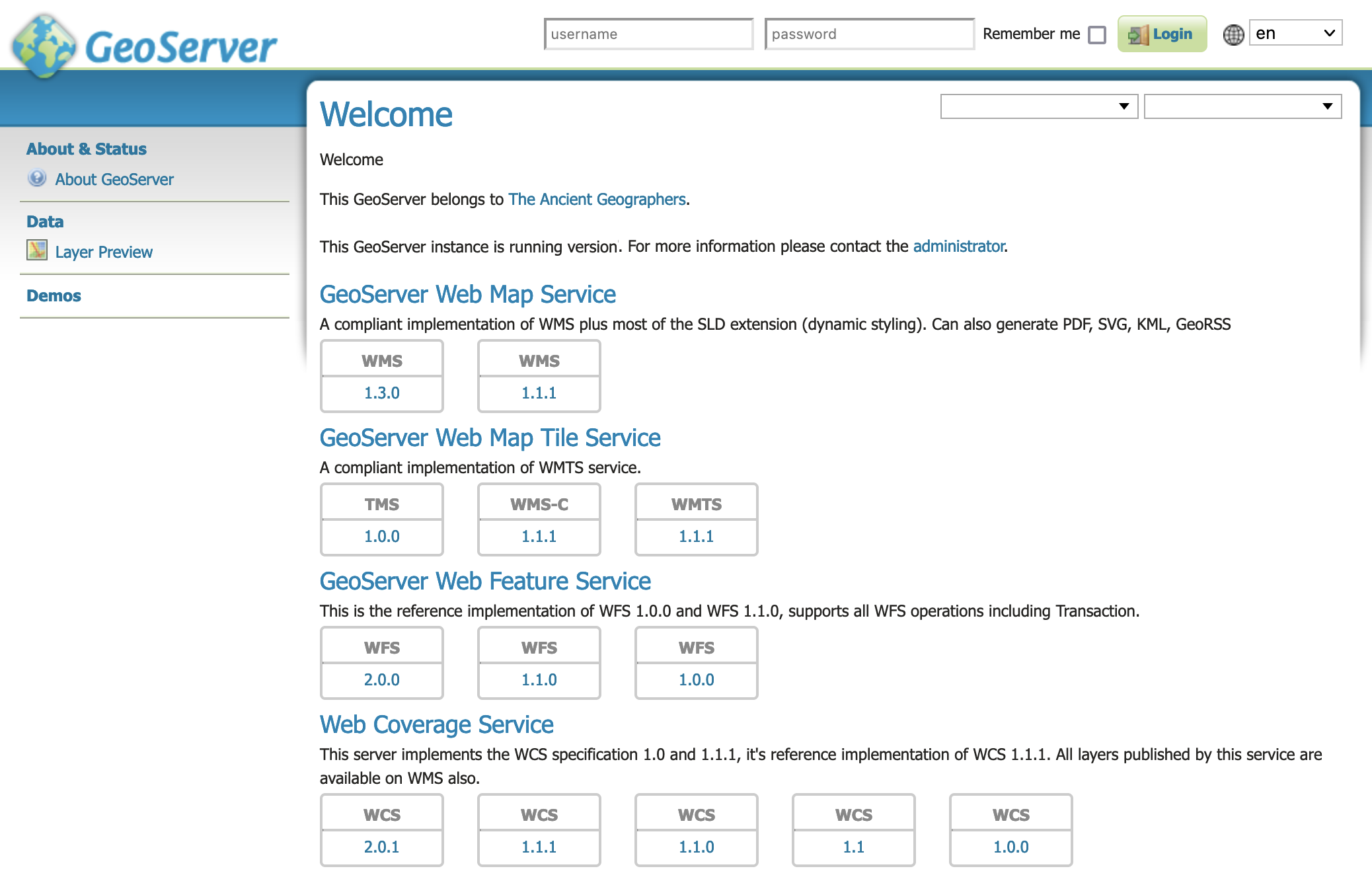
Welcome Page Global Services
To use copy-and-paste the web services URLs into your Desktop GIS or web mapping application.
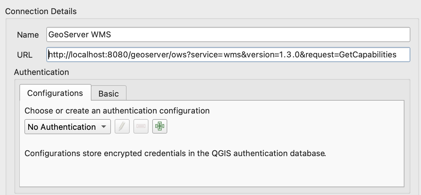
QGIS Desktop GIS WMS Connection
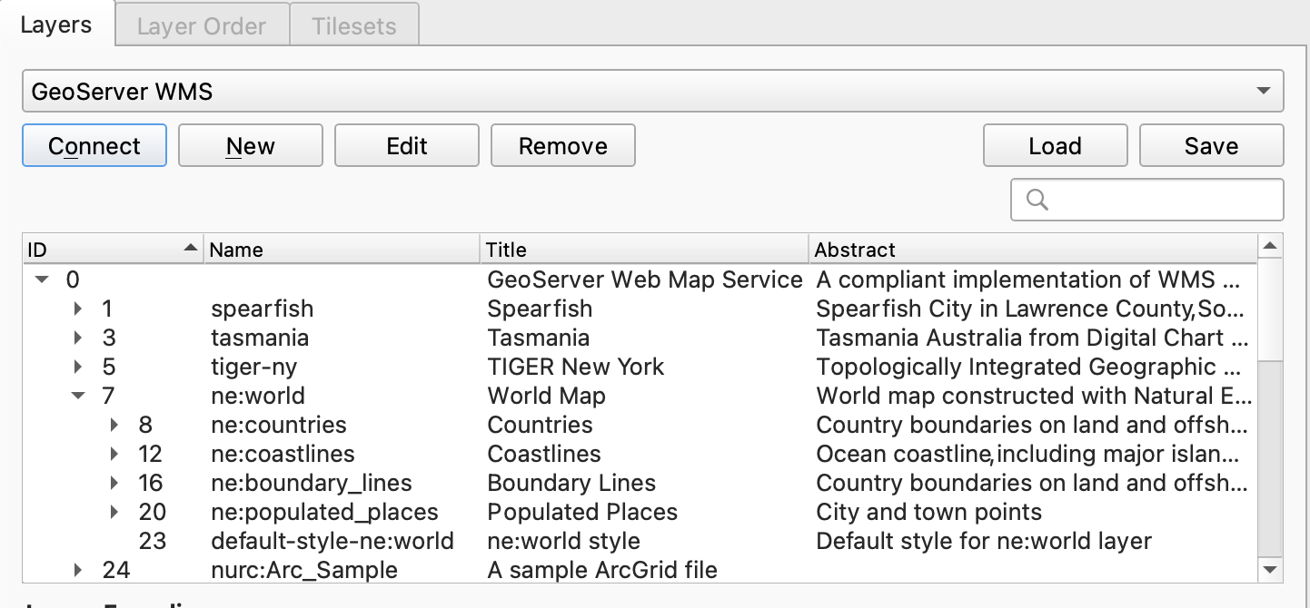
QGIS Desktop GIS Add WMS Layer
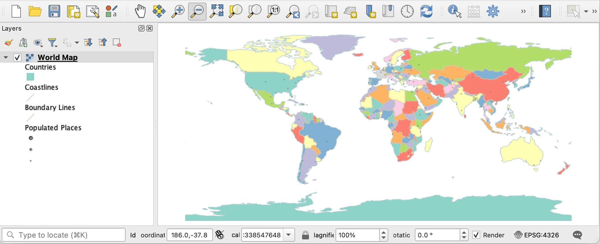
QGIS Desktop GIS Map
Opening these URLs in the browser download or display machine readable the service description.
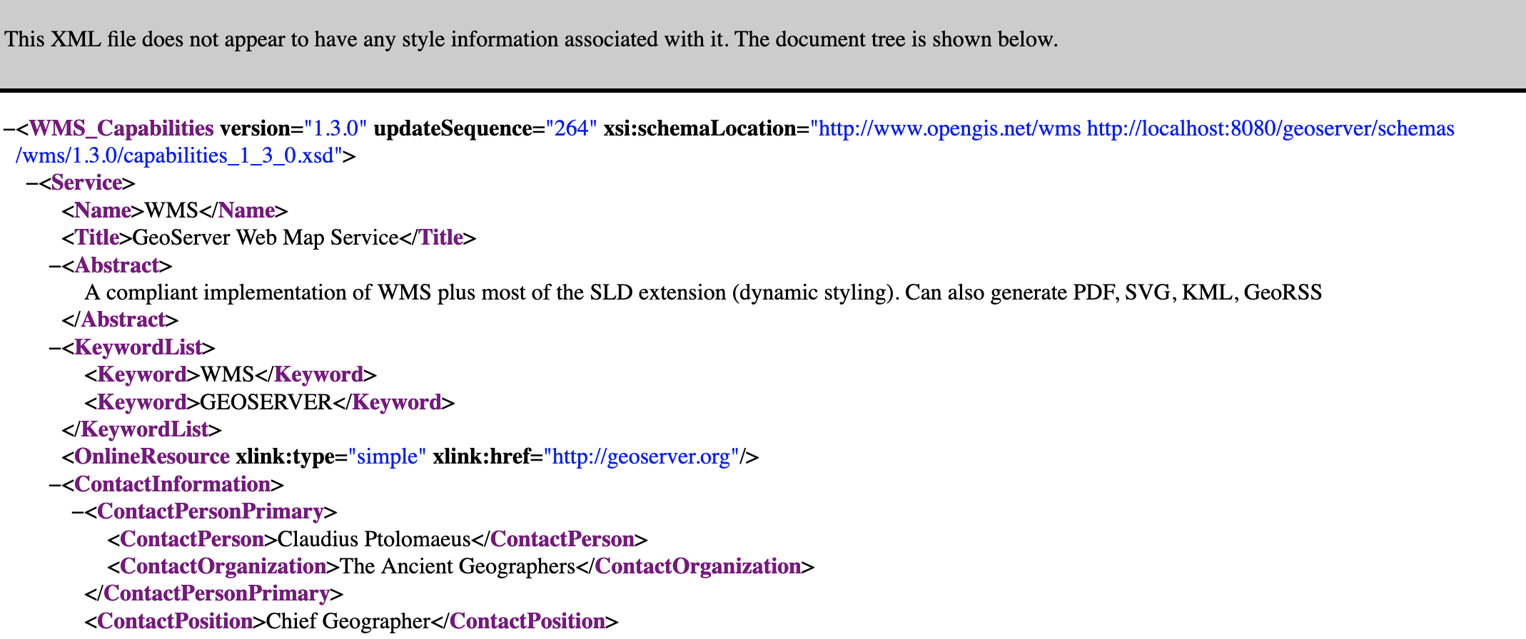
WMS 1.3.0 GetCapabilities Document
If global web services are disabled the initial welcome page web services will not be available.
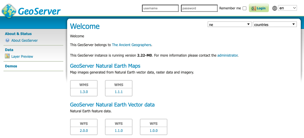
Workspace Web Services
Use workspace select at the top of the welcome page to choose a workspace. The welcome page contact information and web services are updated to match the workspace selected.
Welcome Workspace Web Services
The web service links provided may be used in your Desktop GIS or web mapping application to access the workspace layers.
Layer Web Services
Use the layer select at the top of the welcome page to choose a layer or layer group.
Welcome Workspace Web Services
The workspace select, along with the page contact information and web services are updated to match the layer selected.
Server Overview (Administrators)
When logged in with administrative credentials a configuration overview is provided, along with any information or warning notifications.
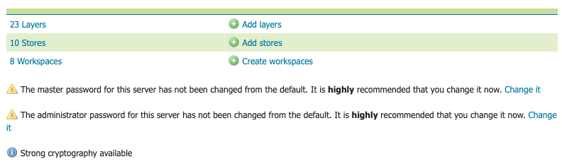
Welcome Administrator Feedback
Click Layers summary link to navigate to the Layers page, press Add layers to create a new layer.
Click Stores summary link to navigate to the Stores page, press Add stores to create a new layer.
Click Workspaces summary link to navigate to the Workspaces page, press Add workspaces to create a new layer.
Information and Warnings
GeoServer status information messages provide feedback on normal operation.
Warnings describe configuration issues to be addressed, often with a short-cut to the configuration page used to address the issue.