Welcome
Welcome to GeoServer Enterprise, and thank you for being a GeoCat customer.
GeoServer is a class-leading application for the publishing of spatial information using international and industry standards. GeoServer provides direct access to feature and raster content, rich cartographic visualization, and geospatial processing. GeoServer integrates smoothly into your existing GIS infrastructure working with database, file, and cloud storage.
GeoCat is a proud open source company, and a core-contributor of GeoServer project. This GeoServer Enterprise release includes the latest GeoServer, GeoWebCache, GeoTools, JAT-EXT, and JTS Topology Suite technologies.
Release notes:
Contact GeoCat BV for more information on this product and the advantages of commercial open source.
Note
This document includes creative commons attribution license content from the GeoServer User Manual , and GeoServer and GeoTools release announcements. Material has been adapted to reflect the GeoServer Enterprise product and visual appearance.
Security
URL Checks
Many OGC protocols encourage communication between systems:
WMS GetMap requests with remote SLD stylesheets (via
sldparameter)Styles referencing remote icons as external graphics
WMS GetMap in feature portrayal mode (using
REMOTE_OWSandREMOTE_OWS_TYPEparameters)WPS remote inputs, either as GET or POST requests
These facilities, while powerful, can be used to implement a Service Side Request Forgery (SSRF) as part of their normal function.
To safely mitigate abuse of OGC protocols for SSRF use page to configure URL Checks. These checks are performed before allowing service operations to contact a remote service. A testing tool is included on this page to verify correct operation.
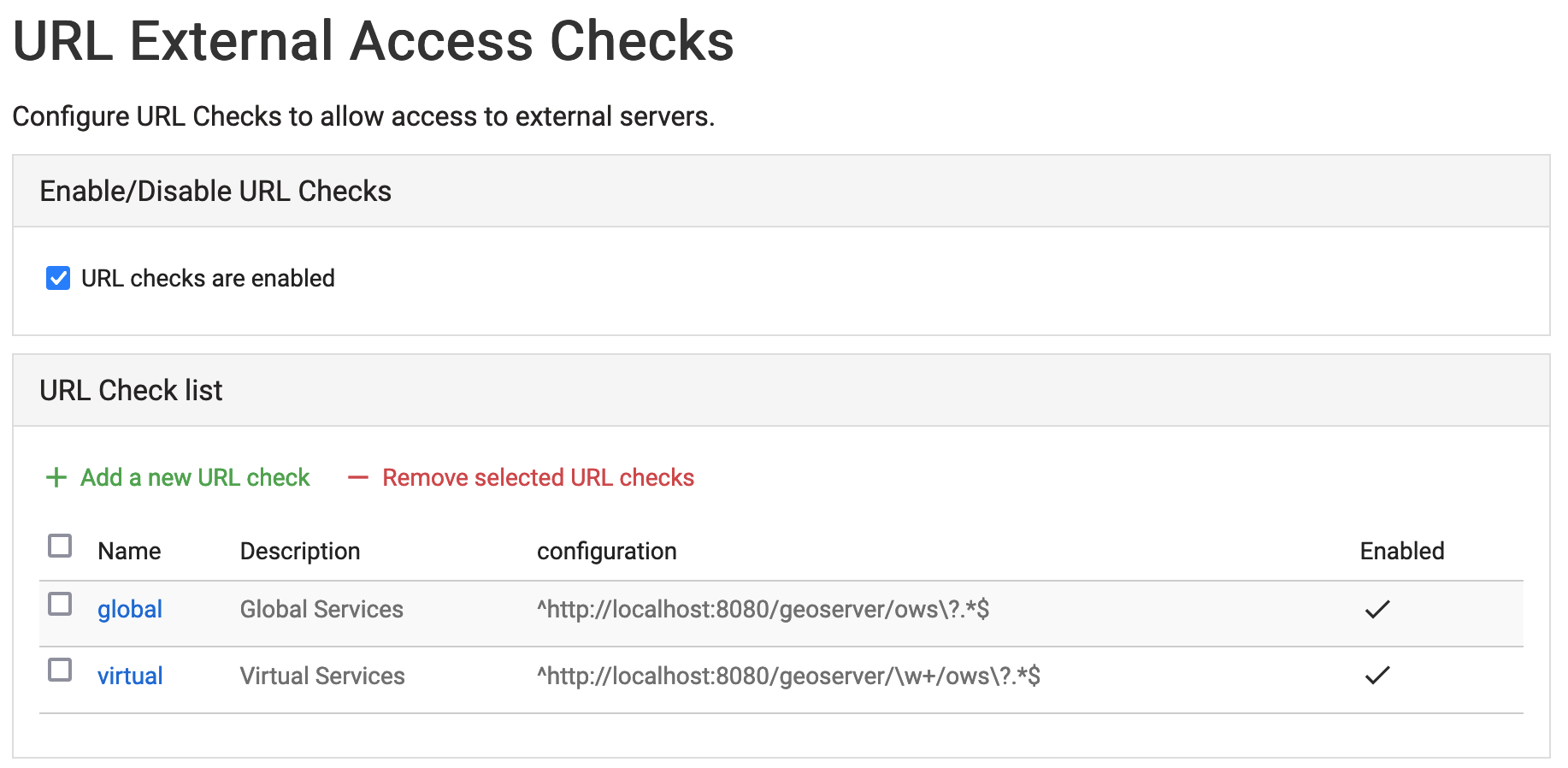
URL Check Page
Reference:
Vector Formats
Feature type customization
Feature type customization allows attributes to be renamed, or even generated on the fly using ECQL expressions.
Update: Feature type customization can now extend to the attribute descriptions; used to provide a human readable text.
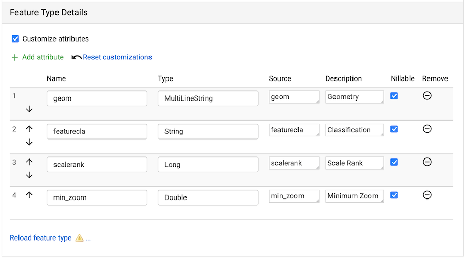
Feature Type customization
Reference:
Web Feature Service
GetFeature output formats
Individual output formats for GetFeature operation can be restricted.
This feature is useful for organization that no longer wish to allow shapefile download.
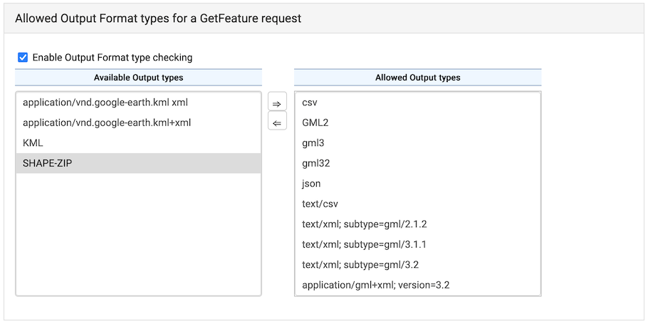
WFS Output format type checking
Configuration
Welcome Page
The welcome page has been improved with a new layout listing each Web Services by title and description, along with a welcome message introducing the GeoServer instances as a whole.
Select a workspace to change the welcome page to display the “virtual web service” for an individual workspace. This is a great approach when providing different projects or teams with their own GIS data services. Organizations making use of this facility often elect to turn off global services.
Select a layer for a “virtual web service” constrained to a single data product suitable for use as an online resource in a metadata record. This is a great approach when working with a GeoServer with tens of thousands of layers which rely on the metadata catalogue for data discovery.
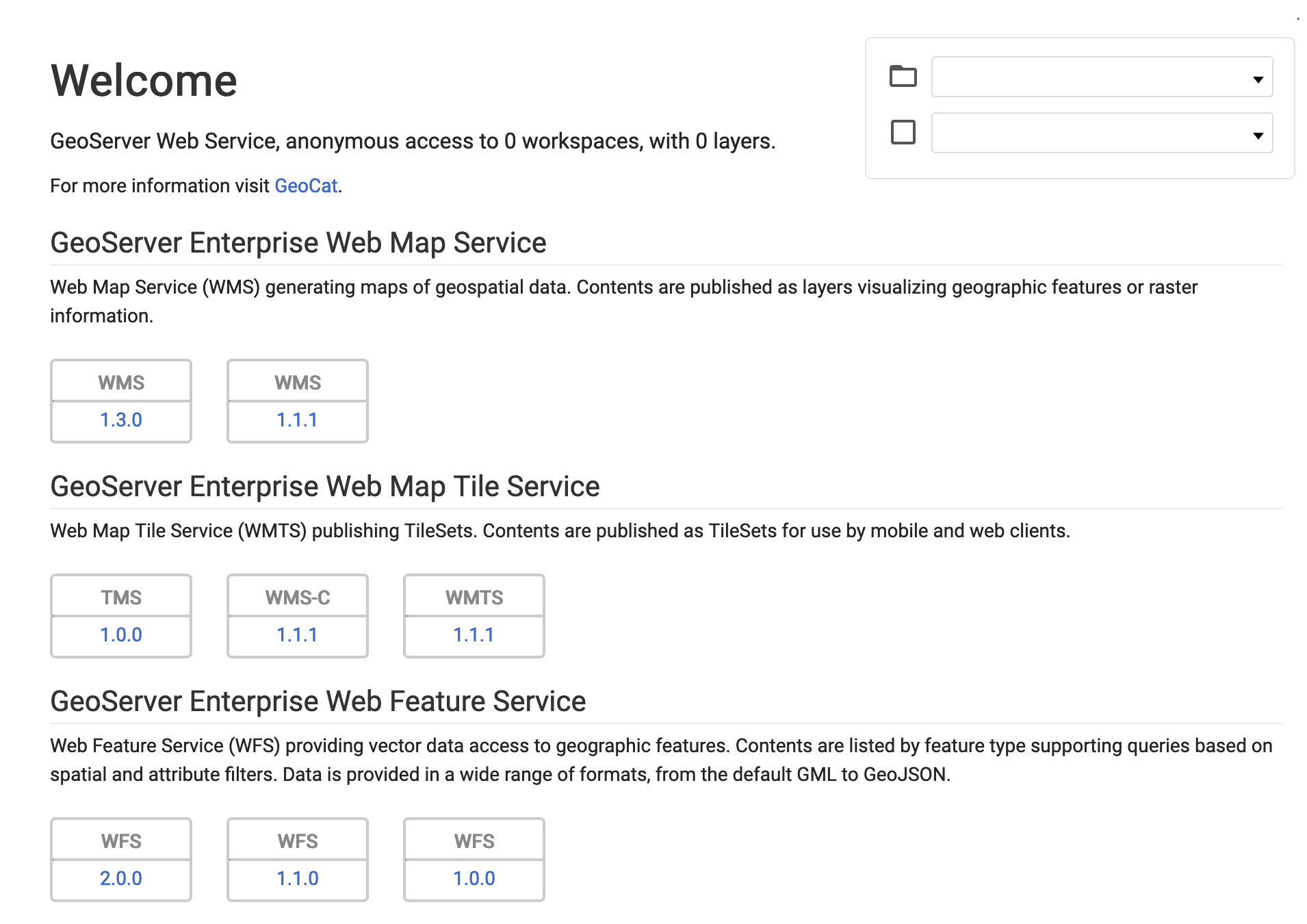
Welcome Page
Language
A language selector is now available.
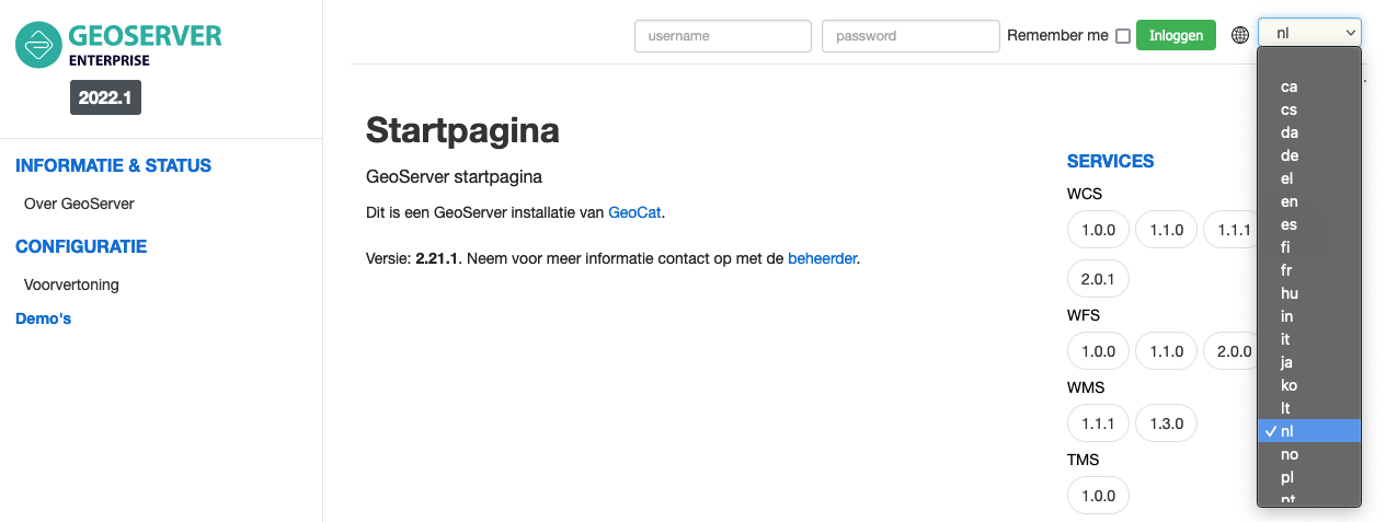
Language Selector
Reference:
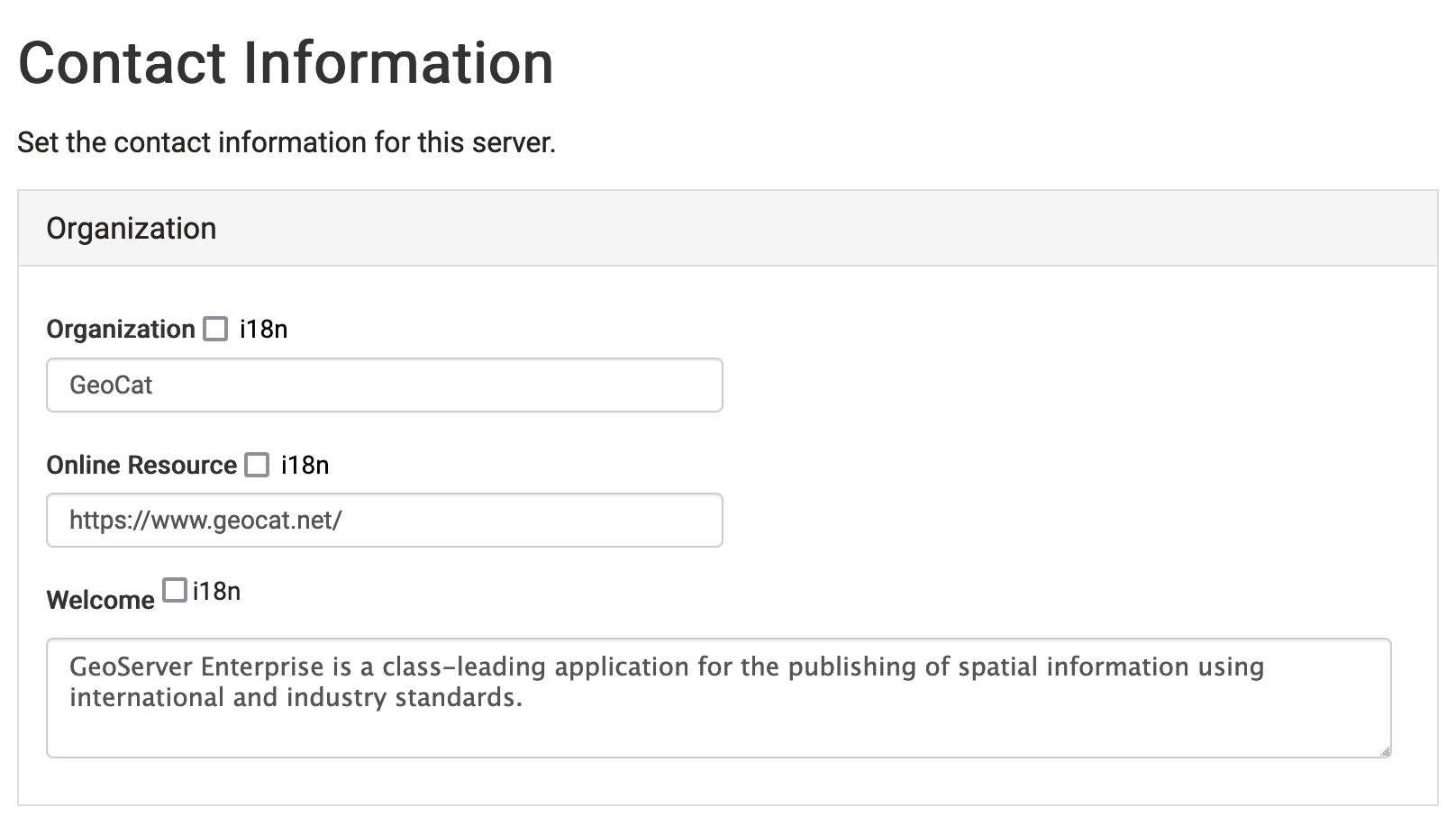
Contact Information
Contact information welcome message is available to provide an introduction.
Contact information organization name and online resource is used to provide an optional link to an organization’s website.
These settings can be overridden on a workspace basis to provide an overview and contact information for a team or project.
Contact information
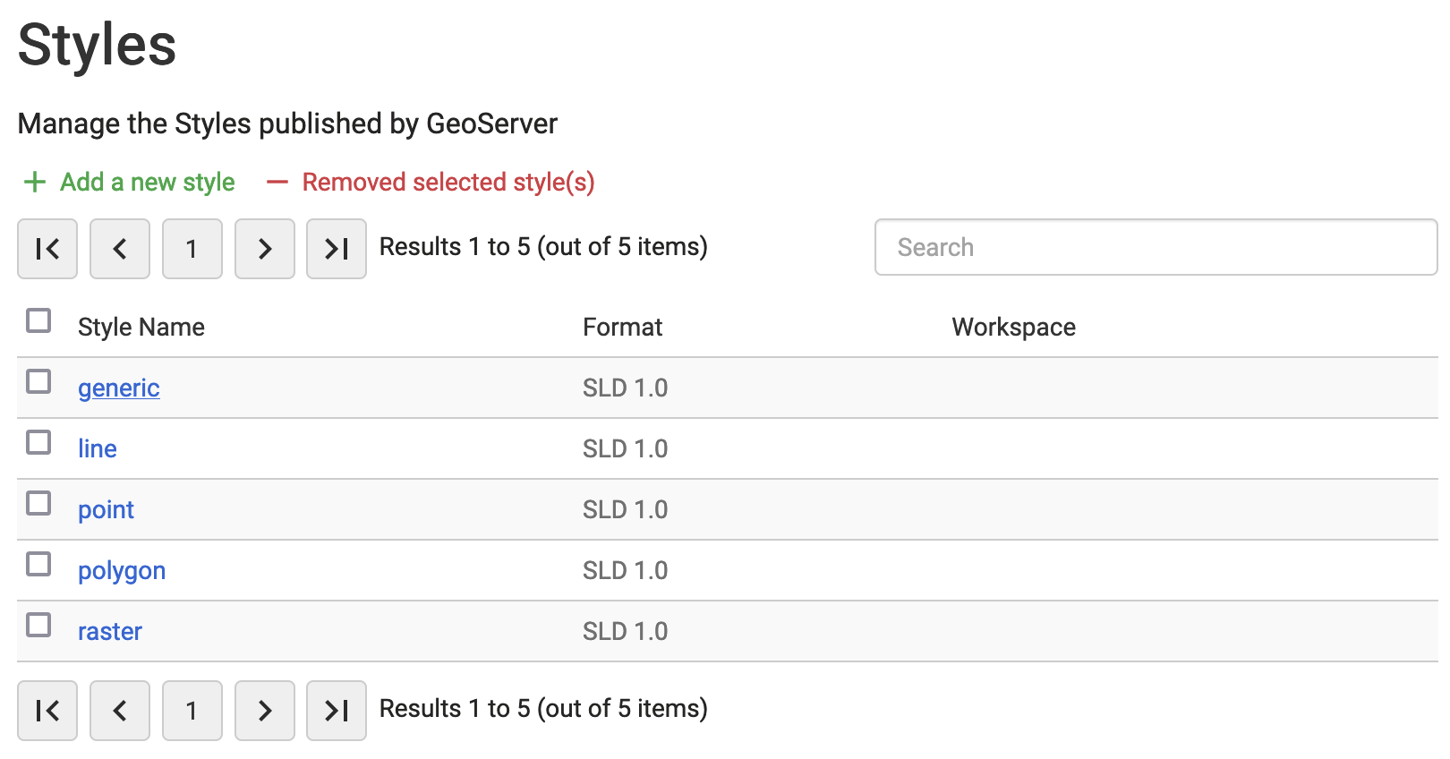
Styles
The style list now includes format information.
Styles List Format
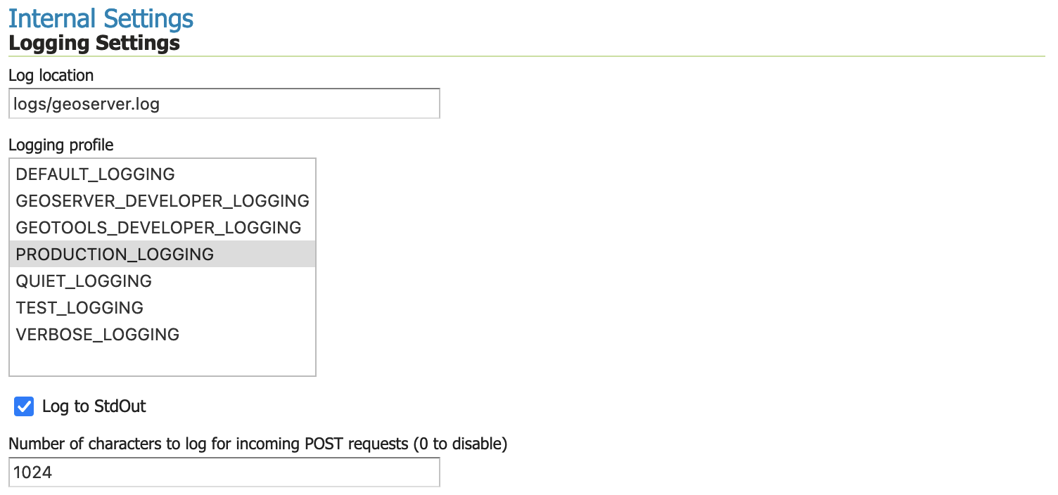
Log4J 2
The application has updated to Log4J 2 for logging services:
The built-in profiles will migrate from
propertiestoxmland will always be kept up to date.Your own logging profiles are defined using a range of formats: xml, properties, json and yaml. Any configuration listed following
logs/*_LOGGGING.*will be available for use.RollingFile appender offers more sophisticated stratagies, with the ability to compress log files once they are no longer in use.
Improved stack-trace representation is available, filtering out internal-java references to improve readability.
Automatic management of built-in logging profiles available with
UPDATE_BUILT_IN_LOGGING_PROFILES=truesystem property.
Global Settings Logging Configuration
Reference:
Request Logging
Request logging is now available as an option in global settings (previously this functionality was on available via editing geoserver.xml or web.xml file.)
The path of each request can be logged along with optionally logging the headers and the request body (for POST requests). When logging request body the number of bytes is logged, along with a snippet up to a maximum size specified.
For customers using oauth open id connect we have found an incompatibility with logging post request

Request logging
Reference:
JVM Console: Java Stack and Heap
A new feature is the ability to report and download:
Java stack information showing what activities are being performed.
Java heap information showing how memory is being used
These facilities are useful for troubleshooting.
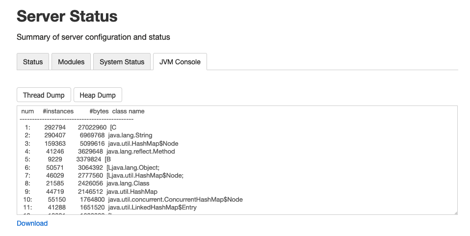
Server Status JVM Console
Reference: