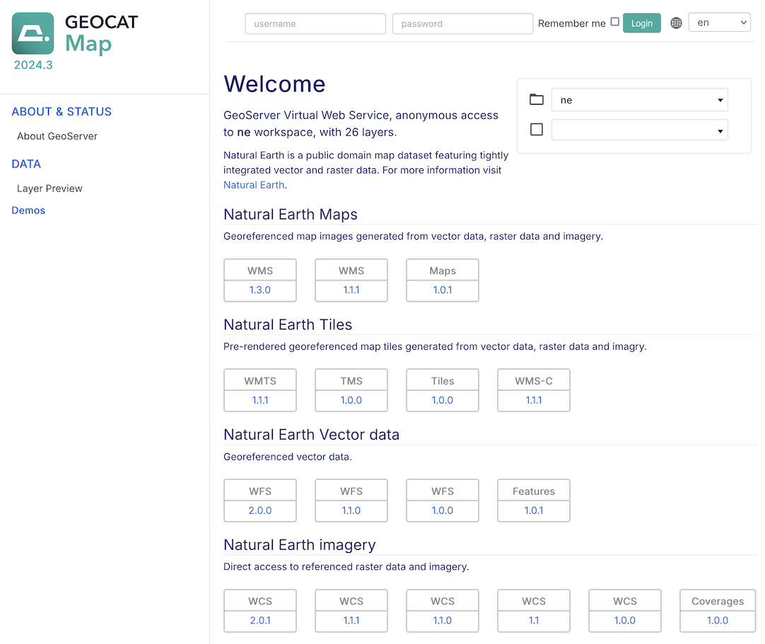
Welcome
Welcome to GeoCat Live Mapping, and thank you for being a GeoCat customer.
GeoServer is a class-leading application for the publishing of spatial information using international and industry standards. GeoServer provides direct access to feature and raster content, rich cartographic visualization, and geospatial processing. GeoServer integrates smoothly into your existing GIS infrastructure working with database, file, and cloud storage.
GeoCat is a proud open source company, and a core-contributor of GeoServer project. This GeoServer Enterprise release includes the latest GeoServer, GeoWebCache, GeoTools, JAT-EXT, and JTS Topology Suite technologies.
GeoCat Live Mapping 2026.0 Mapping update
GeoCat Live Standard:
OGC API - Features
The next generation WFS standard from OGC is now available for all customers. This is a REST / JSON service defined by the Open Geospatial Consortium.
GeoServer implements this as a new vector service alongside existing WFS 1.0, WFS 1.1 and WFS 2.0 web services. OGC API Features can be configured by enabling / disabling optional functionality such as CQL2 and ECQL queries.
Conformances are categories into STANDARD, DRAFT STANDARD, and COMMUNITY STANDARD allowing additional functionality to be evaluated and used.
Content Security Policy
While this is an appreciated new security feature early testing found several configuration screens were un responsive with this policy in place. While these have been addressed, please be aware of the change and contact support if you have any difficulty.
Performance improvements
A wide range of performance improvements: multi threaded catalog loading and cover view reader, meta-tiling, coordinate reference system lookup, and KML output format.
File System sandbox isolation
This feature is available on request, used to strictly limit data access to the webdav folder, or the webdav folder and
wwwfolder (for staging data for download access).
GeoCat Live Premium:
MapML
Support for latest 0.16.0 MapML Viewer, and new MapML TCRS Settings configuration page.
Reference:
Contact GeoCat bv for more information on this product and the advantages of commercial open source.
Note
This document includes creative commons attribution license content from the GeoServer User Manual , and GeoServer and GeoTools release announcements. Material has been adapted to reflect the GeoServer Enterprise product and visual appearance.
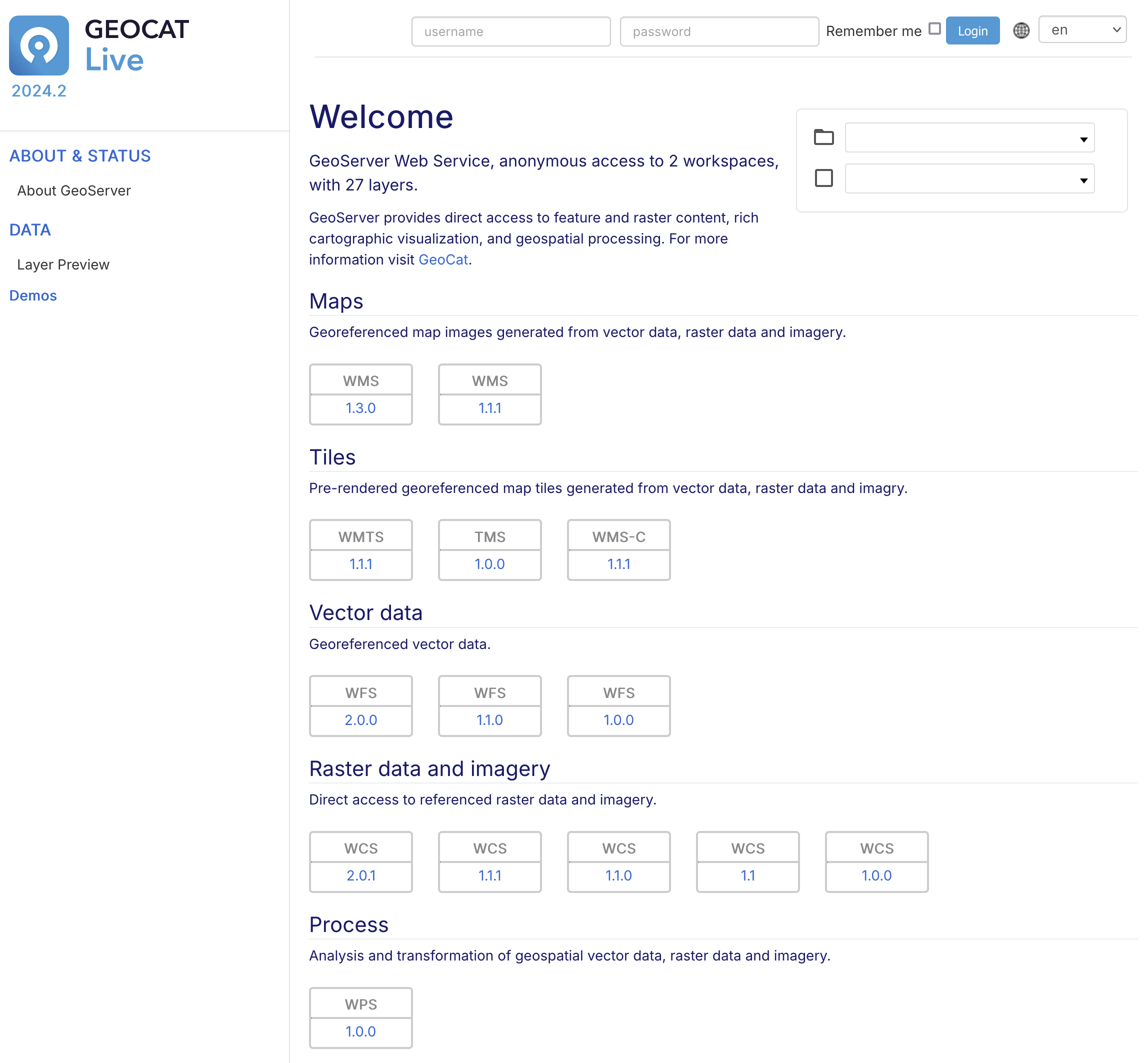
User experience
GeoCat Map Theme
For 2025 GeoServer Enterprise is being renamed to GeoCat Map with a theme update to match the GeoCat website.
This theme is being tested presently and is available on request.
GeoCat Map Theme
GeoCat Map Live Theme
The GeoCat Live theme has been updated to reflect the new GeoCat Website. available.
GeoCat Live Theme
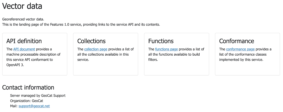
Web Feature Service
OGCAPI Features Service
Modern, web-friendly OGC API - Features standard provides a REST / JSON Web Service for vector data. OGCAPI Services can also be browsed directly in the browser, and feature a full OpenAPI web service definition for accessing feature content programatically.
OGCAPI Services are handled as another protocol - as a result Vector data services include WFS 1.0, WFS 1.1, WFS 2.0 and the new OGCAPI - Features service.
Configure OGCAPI Features Service alongside Services > WFS in the Admin Console. GeoServer implementation features support for the latest CQL2 specification, while allowing the use of the traditional ECQL2 community standards. These individual features, including draft standards, are configured by selecting the “conformances” you wish to enable.
Reference: