Quick start
GeoNetwork is a catalog application to manage spatially referenced resources. It provides powerful metadata editing and search functions as well as an interactive web map viewer. It is currently used in numerous Spatial Data Infrastructure initiatives across the world.
Apart from how to start the catalog, this Quick Start describes:
some of the different ways you can search for spatial data
how to download and display data from the search results
Starting the catalog
After going through the installer steps, simply go to bin folder and click on start.bat (on windows) or startup.sh (on linux).
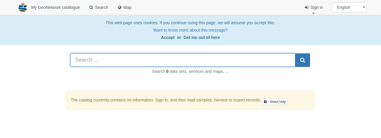
Open a web browser and go to the GeoNetwork homepage. If you installed it on your computer, this is probably at http://localhost:8080/geonetwork.
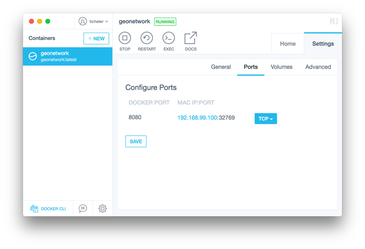
When you use Docker, you can find our what IP and Port to connect to from the Kitematic application. Or run docker ps in a terminal (on Linux or OSX). This should give you the port the Docker is running on.
Your opening screen should look like this:
Signing in and load templates
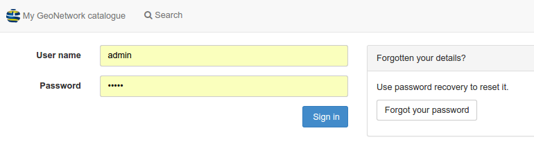
Click the sign in to connect as administrator. The default account is
username admin with password admin.
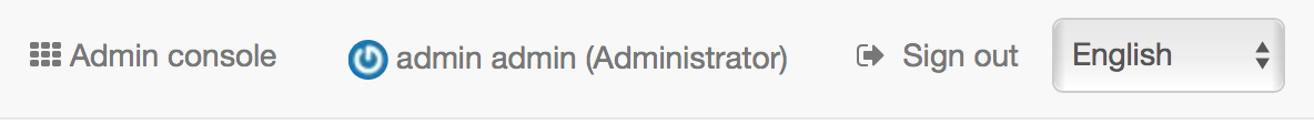
Once connected, the top toolbar should provide a link to the admin console
and your login details.
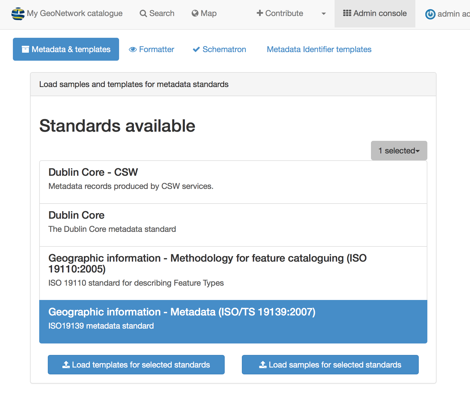
Go to the admin console and click on metadata and templates:
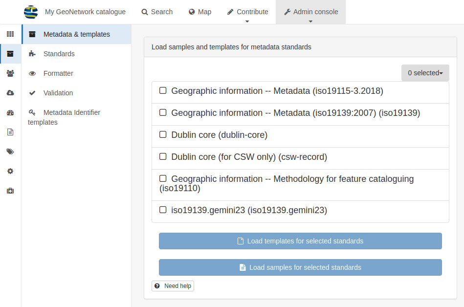
Choose all standards and click load samples and then load templates in
order to load examples:
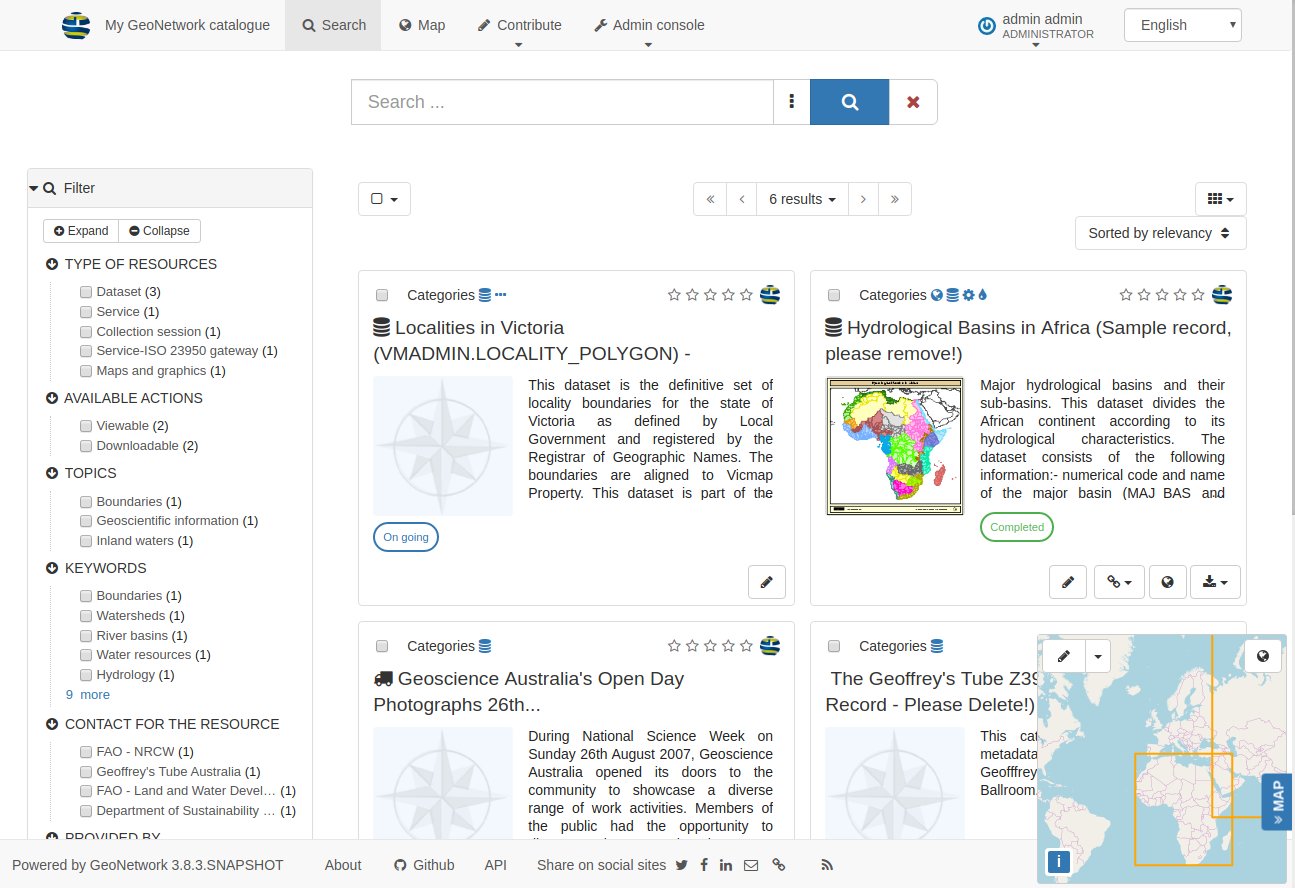
Go back to the search page to see examples:
Searching information
The search form provides different ways for search:
a full text search box providing suggestions
facets which defines groups that you can easily click on to browse the content of the catalog
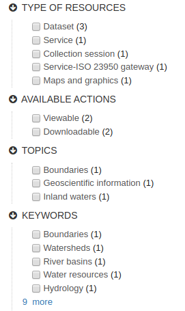
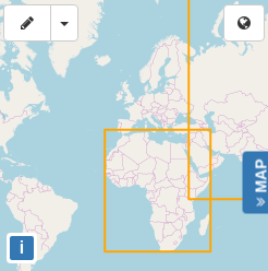
spatial filtering to choose information in specific areas
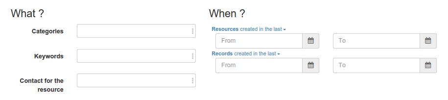
advanced search
Discovering information
Search results present main information about each resources: title, abstract, categories, status, overview and links.
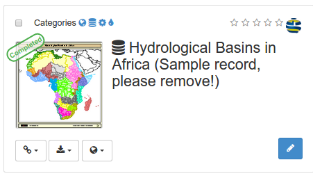
Clicking the record will provide more in depth details about the resources:
Download and links
About the resource
Technical information
Metadata details
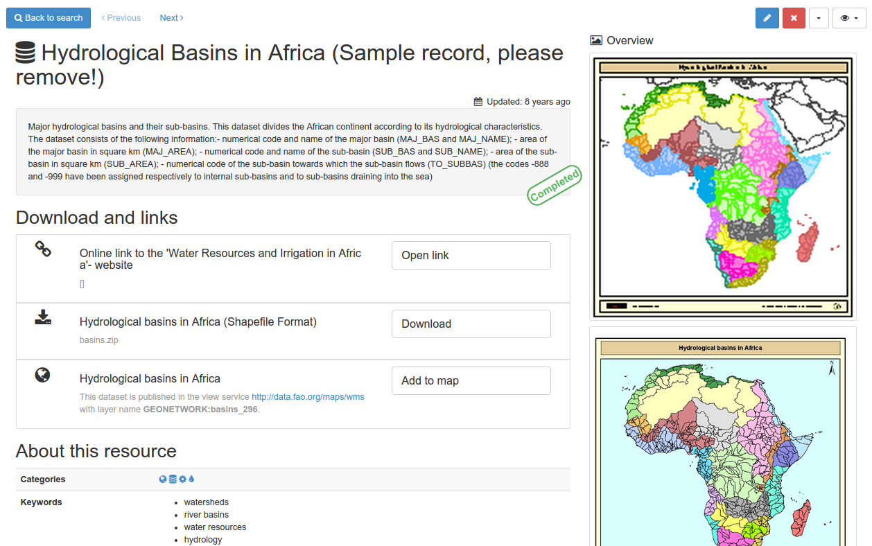
To get more information, switch the advanced view mode. To update the record, click the edit button.
From the results or the record view, you can easily add WMS layers referenced in a metadata record on the map. With the map, you can visualize your data, choose your background maps, query objects, display on a 3D globe and more …
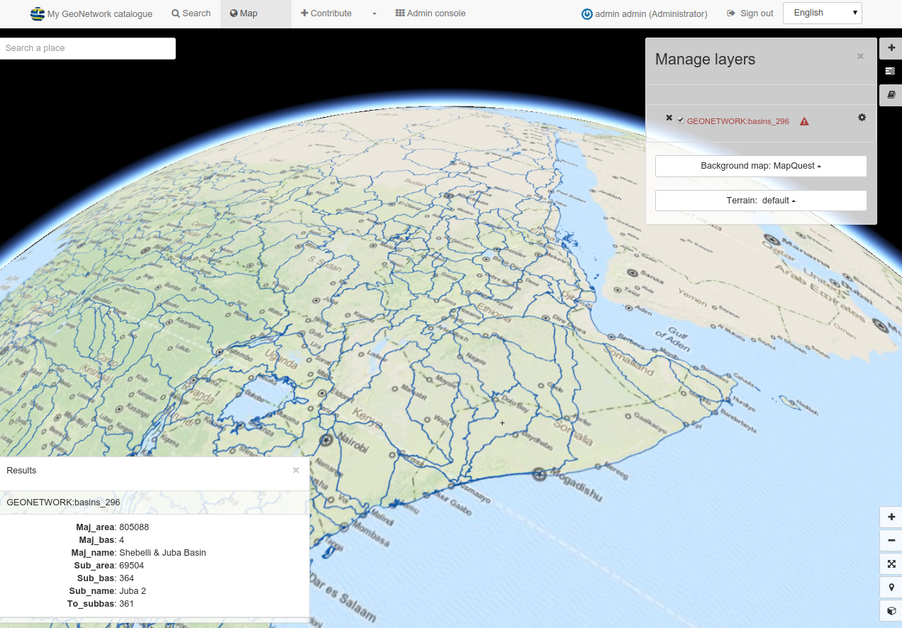
Read more about use of the Maps and dataset visualisation