ImageMosaic configuration
Granules
Each individual image is commonly referred to as a granule. In recent releases of GeoServer the similarities requirements for the granules have been dropped significantly, including:
The granules do not need to share the same coordinate reference system (see the multi-CRS mosaic tutorial)
The granules can be in different color models, with an allowance of mixing gray, RGB, RGBA and indexed color granules (it is however not possible to mix colored granules with scientific data types like as float/double). In order to benefit of mixed color models JAI-Ext support must be enabled, see the JAI-EXT support documentation.
In addition it is worth remarking on the fact that currently the ImageMosaic is able to handle raster data whose grid-to-world transformation is a scale and translate transformation, hence no rotation or skew.
Index and configuration file creation
When a new store is created, an index shapefile will be generated to associate each granule file with its bounding box. The index creation respects directory trees as well as single directories. All you need to do is point the store to the root of the hierarchy, and all images will be considered for inclusion in the ImageMosaic.
The index will contain the enclosing polygon for each raster file (in an appropriate coordinate reference system) and the path to each of these files. The location attribute can be relative to the configuration folder or absolute. By default, the name of this attribute is location, but this can be changed in the main configuration file.
If you already have these files generated, GeoServer will respect them and not generate a new index. By default, a shapefile is used for the index, but PostGIS, H2, and Oracle are also supported, with additional configuration steps.
Configuration files
Within each store there are multiple configuration files that determine how the mosaic is rendered.
Note
The property file syntax uses a few reserved chars that need escaping in order to be used for keys or values. For example, the # character is used to comment out lines, in order to use it in values it needs to be escaped, like this: \#. The same applies to the = character, which is used to separate the property name from its value: it should be specified as \=. Finally, if there is a need to use the \ itself, it will have to be escaped as well: \\.
Primary configuration file
The mosaic configuration file is the primary file used to store the configuration parameters that control the ImageMosaic plugin. When created by GeoServer it is by default called <directory>.properties, where <directory> is the name of the root directory of the store. (It is not related to the store name in GeoServer.) It can have other names, as long as it does not conflict with other files such as datastore.properties or indexer.properties. This file usually does not require manual editing.
The table below describes the various elements in this configuration file.
Parameter |
Mandatory? |
Description |
|---|---|---|
Levels |
Y |
Represents the resolutions for the various levels of the granules of this mosaic. |
Heterogeneous |
N |
Sets whether the image files are heterogeneous. Default is |
AbsolutePath |
N |
Controls whether or not the path stored inside the |
Name |
N |
The name to be assigned to the index. If unspecified, the index name will usually match the name of the folder containing the mosaic. |
TypeName |
Y |
Featuretype name for this mosaic. Usually the name as |
Caching |
N |
Boolean value to enable caching. When set to |
ExpandToRGB |
N |
Boolean flag to force color expansion from index color model (paletted datasets) to component color model (RGB). Default is |
LocationAttribute |
Y |
The name of the attribute path in the shapefile index. Default is |
SuggestedSPI |
Y |
Suggested plugin for reading the image files. |
SuggestedFormat |
N |
Suggested GridFormat for reading the image files. |
Envelope2D |
N |
Envelope for the mosaic formatted as |
CheckAuxiliaryMetadata |
N |
This parameter allows to specify whether the ImageMosaic plugin should check for the presence of a GDAL aux.xml file beside each granule file. For most common use cases, you don’t need to set or specify this parameter. Being disabled by Default, ImageMosaic won’t look for an ancillary file for each granule being initialized in the GranuleCatalog. This avoid useless checks, especially when dealing with thousand of granules. You should set that parameter to |
LevelsNum |
Y |
Represents the number of reduced resolution layers that we currently have for the granules of this mosaic. |
A sample configuration file follows:
Levels=0.4,0.4
Heterogeneous=false
AbsolutePath=false
Name=osm
TypeName=osm
Caching=false
ExpandToRGB=false
LocationAttribute=location
SuggestedSPI=it.geosolutions.imageioimpl.plugins.tiff.TIFFImageReaderSpi
SuggestedFormat=org.geotools.gce.geotiff.GeoTiffFormat
CheckAuxiliaryMetadata=false
LevelsNum=1
datastore.properties
By default the ImageMosaic index is specified by a shapefile, which is located at the root of the ImageMosaic directory, just like the primary configuration file.
If needed, different storage can be used for the index — like a spatial DBMS, which is the preferred solution when you wish to share the ImageMosaic itself in a cluster of GeoServer instances. In this case the user must supply GeoServer with the proper connection parameters, which can be specified by using a datastore.properties file placed at the root of the ImageMosaic directory.
Note
A shapefile is created automagically if it does not exist or if there is no datastore.properties file.
Warning
At the time of writing the following spatial DBMS have been tested successfully: Oracle, PostgreSQL, H2, SQLServer.
Parameter |
Mandatory? |
Description |
|---|---|---|
StoreName |
N |
Can be used to refer to a GeoServer registered store, using a “workspace:storeName” syntax. When this is used, the no other connection parameters need to be provided. The SPI can still be provided to inform the mosaic of the resulting type of store (e.g., Oracle) in case specific behavior need to be enacted for it (e.g., in the case of Oracle the attributes are all uppercase and cannot be longer than 30 chars, the mosaic will respect the limits but the SPI parameter needs to be explicitly set to org.geotools.data.oracle.OracleNGDataStoreFactory as the actual store type is hidden when it reaches the mosaic code). Also, as a reminder, the code is picking up a Store reference, not a layer one, meaning that security restrictions that might have been applied to a layer exposing the feature type do not apply to the mosaic code (e.g., if a user has restrictions such as a spatial filter on said layer, it won’t transfer to the mosaic, which needs to be secured separately) |
SPI |
Y |
The DataStoreFactory used to connect to the index store:
JNDI can also be used with any of these stores. If JNDI is used, the DataStoreFactory name will differ from the above. |
Connection parameters |
Y |
The connection parameters used by the specified SPI. The list of these connection parameters can be found in the GeoTools documentation on the relevant store: If JNDI is used, the connection parameters will include |
Here is a sample datastore.properties file for a PostGIS index:
SPI=org.geotools.data.postgis.PostgisNGDataStoreFactory
host=localhost
port=5432
database=osm
schema=public
user=user
passwd=password
Loose\ bbox=true
Estimated\ extends=false
validate\ connections=true
Connection\ timeout=10
preparedStatements=true
Here is a sample datastore.properties file for a PostGIS index via JNDI:
SPI=org.geotools.data.postgis.PostgisNGJNDIDataStoreFactory
#String
# JNDI data source
# Default "java:comp/env/"+"jdbc/mydatabase"
jndiReferenceName=

#Boolean
# perform only primary filter on bbox
# Default Boolean.TRUE
Loose\ bbox=true

#Boolean
# use prepared statements
#Default Boolean.FALSE
preparedStatements=false
indexer.properties
In addition to the required envelope and location attributes, the schema for the index store may expose other custom attributes which can be used later for filtering the ImageMosaic granules on the fly during a WMS or WCS request or to diver WMS and WCS dimensions like TIME, ELEVATION and so on. This is configured by the indexer.properties file:
Parameter |
Mandatory? |
Description |
|---|---|---|
Schema |
Y |
A comma-separated sequence describing the mapping between attribute and data type. |
PropertyCollectors |
Y |
A comma-separated list of PropertyCollectors. Each entry in the list includes the extractor class, the file name (within square brackets |
TimeAttribute |
N |
Specifies the name of the time-variant attribute. |
ElevationAttribute |
N |
Specifies the name of the elevation attribute. |
AuxiliaryFile |
N |
Path to an auxiliary file to be used for internal purposes (For example: when dealing with NetCDF granules, it refers to the NetCDF XML ancillary file.) |
AbsolutePath |
N |
Controls whether or not the path stored inside the |
Caching |
N |
Boolean value to enable caching. When set to |
CanBeEmpty |
N |
Boolean flag used for configuring empty mosaics. When enabled the ImageMosaic will not throw an exception caused by the absence of any coverage. By default it is set to |
Envelope2D |
N |
Envelope for the mosaic formatted as |
ExpandToRGB |
N |
Boolean flag to force color expansion from index color model (paletted datasets) to component color model (RGB). Default is |
IndexingDirectories |
N |
Comma separated values list of paths referring to directories containing granules to be indexed. If unspecified, the IndexingDirectory will be the mosaic configuration directory. This parameter allows configuration of a mosaic in a folder which contains only configuration files, while the granules to be indexed are stored somewhere else. |
Name |
N |
The name to be assigned to the index. If unspecified, the index name will usually match the name of the folder containing the mosaic. |
NoData |
N |
Specifies the NoData for the mosaic. (This might be useful, as an instance, when imposing the Envelope2D. At time of ImageMosaic’s initialization, a small 5x5 pixels sample read is performed by ImageMosaic on the Envelope’s corner in order to retrieve granule’s metadata and properties, as nodata. If Envelope2D is forced in configuration, there might be the case that this sample read will not involve any actual granule so a default noData will be set which may be different with respect to what is actually stored on granules. Specifying the desired NoData property in indexer will solve this type of issue). |
CoverageNameCollectorSPI |
N |
As described in the previous row, the Name parameter allows specification of the coverage name to be exposed by the ImageMosaic. An ImageMosaic of NetCDFs instead exposes a coverage for each supported variable found in the NetCDF, using the variable’s name as the coverage name (for instance, air_temperature, wind_speed, etc.) The optional CoverageNameCollectorSPI property allows specification of a CoverageNameCollector plugin to be used to instruct the ImageMosaic on how to setup different coverageNames for granules. It should contains the full name of the implementing class plus an optional set of semicolon-separated keyValue pairs prefixed by “:”. See below for an example. |
Recursive |
N |
Boolean flag used at indexing time. When set to |
UseExistingSchema |
N |
Boolean flag used for enabling/disabling the use of existing schemas. When enabled, the ImageMosaic will start indexing granules using the existing database schema (from |
Wildcard |
N |
Wildcard used to specify which files should be scanned by the indexer. (For instance: “*.tif”). Currently, logic operators and lists aren’t supported, so this field is limited to a single wildcard element with no support for AND/OR operators combinations. |
WrapStore |
N |
By default, Postgresql identifiers can’t be longer than 63 chars. Longer names will be truncated to that fixed length. When dealing with multidimensional datasets (for instance: NetCDFs, GRIBs) each variable (NetCDF) or parameter (GRIB) is indexed into a table with the same name. Therefore an atmosphere-absorption-optical-thickness-due-to-particulate-organic-matter-ambient-aerosol-particles NetCDF CF variable will be associated to a table with the same name. Postgresql will truncate that to atmosphere-absorption-optical-thickness-due-to-particulate-orga breaking the one-to-one mapping and therefore breaking the proper functioning. Setting the WrapStore flag to |
MosaicCRS |
N |
The “native” CRS of the mosaic, that is, the one in which footprints are collected. Useful when dealing with granules in multiple CRSs (see tutorial) |
AdditionalDomainAttributes |
N |
Comma separate list of custom dimensions to be exposed. Each custom dimension declaration can be a simple attribute name from the
schema, e.g., |
PropertySelection |
N |
Boolean value to enable/disable selection of properties from the mosaic index. Default is |
Here is a sample indexer.properties file:
Schema=*the_geom:Polygon,location:String,ingestion:java.util.Date,elevation:Double
PropertyCollectors=TimestampFileNameExtractorSPI[timeregex](ingestion),DoubleFileNameExtractorSPI[elevationregex](elevation)
TimeAttribute=ingestion
ElevationAttribute=elevation
Caching=false
AbsolutePath=false
An example of optional CoverageNameCollectorSPI could be:
CoverageNameCollectorSPI=org.geotools.gce.imagemosaic.namecollector.FileNameRegexNameCollectorSPI:regex=^([a-zA-Z0-9]+)
This defines a regex-based name collector which extracts the coverage name from the prefix of the file name, so that an ImageMosaic with temperature_2015.tif, temperature_2016.tif, pressure_2015.tif, pressure_2016.tif will put temperature* granules on a temperature coverage and pressure* granules on a pressure coverage.
Note
The extraction works from the match of the full regular expression, if there are no capturing groups. If there are capturing groups instead, the match will be the concatenation of the text matched by all the capturing groups. This can be used to simplify the regular expression, for example, in order to match a string surrounded by underscores, regex=.*_(\\w+)_.* can be used instead of the more complex regex=(?<\=_)\\w+(?\=_) (using non capturing groups instead).
Property collectors
The following table enumerates the available property collectors
Collector SPI name |
Description |
|---|---|
ByteFileNameExtractorSPI DoubleFileNameExtractorSPI FloatFileNameExtractorSPI IntegerFileNameExtractorSPI LongFileNameExtractorSPI ShortFileNameExtractorSPI |
Extracts an number from the file name using a regular expression specified in a sidecar file, casting it to the desired type based on the SPI name (e..g, DoubleFileNameExtractorSPI extracts double precision floating points, IntegerFileNameExtractorSPI extracts 32 bit integers) |
TimestampFileNameExtractorSPI |
Extracts a timestamp from the filename using a regular expression specified in a sidecar file |
StringFileNameExtractorSPI |
Extracts a string from the filename using a regular expression specified in a sidecar file |
CurrentDateExtractorSPI |
Returns the current date and time (useful to track ingestion times in a mosaic) |
FSDateExtractorSPI |
Returns the creation date of the file being harvested |
DateExtractorSPI |
Returns the date found in tiff file header “DateTime” (code 306) |
ResolutionExtractorSPI ResolutionXExtractorSPI ResolutionYExtractorSPI |
Returns the native resolution of the raster being harvested. ResolutionExtractorSPI and ResolutionXExtractorSPI return the x resolution of the raster, ResolutionYExtractorSPI returns the resolution on the Y axis instead |
CRSExtractorSPI |
Returns the code of the raster coordinate reference system, as a string, e.g. “EPSG:4326” |
The PropertyCollectors parameter in the example above indicates two additional .properties files used to populate the ingestion and elevation attributes:
timeregex.properties:
regex=[0-9]{8}T[0-9]{9}Z(\?!.\*[0-9]{8}T[0-9]{9}Z.\*)
The above is a property file containing a regex used to extract Date and Time represented in ISO-8601 as part of the filename. (Note the T char between digits for date and digits for time, as per ISO-8601)
In case of custom format datetimes in filename, an additional format element should be added after the regex, preceded by a comma, defining the custom representation.
regex=.*([0-9]{10}).*,format=yyyyMMddHH
In case of reduced precision of temporal information, where there is the need to get the higher time included in that reduced value, an additional ,useHighTime=true element should be added.
regex=.*([0-9]{10}).*,format=yyyyMMddHH,useHighTime=true
In case the temporal information is spread along the whole file path, an additional ,fullPath=true element should be added.
regex=(?:/)(\d{8})(?:/)(?:Temperature.)(T\d{4})(?:.tif),fullPath=true
elevationregex.properties:
regex=(?<=_)(\\d{4}\\.\\d{3})(?=_)
Store parameters
By default, ImageMosaic will be an option in the Raster Data Sources list when creating a new data store.
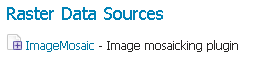
ImageMosaic in the list of raster data stores
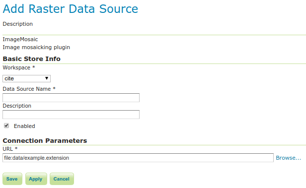
Configuring an ImageMosaic data store
Option |
Description |
|---|---|
Workspace |
Workspace for the store |
Data Source Name |
Name of the store |
Description |
Description of the store |
Enabled |
Determines whether the store is enabled. If unchecked, all layers in the store will be disabled. |
URL |
The location of the store. Can be a local directory. |
Coverage parameters
Creation of the store is the first step to getting an ImageMosaic published in GeoServer. Most of the configuration is done when publishing the resulting coverage (layer).
The Coverage Editor gives users the possibility to set a few control parameters to further control the mosaic creation process.
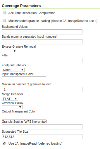
Coverage parameters
The parameters are as follows:
Parameter |
Description |
|---|---|
Accurate resolution computation |
Boolean value. If |
AllowMultithreading |
If |
BackgroundValues |
Sets the value of the mosaic background. Depending on the nature of the mosaic it is wise to set a value for the “nodata” area (usually -9999). This value is repeated on all the mosaic bands. |
Filter |
Sets the default mosaic filter. It should be a valid ECQL query to be used by default if no Note Do not use this filter to change time or elevation dimensions defaults. It will be added as AND condition with CURRENT for “time” and LOWER for “elevation”. |
FootprintBehavior |
Sets the behavior of the regions of a granule that are outside of the granule footprint. Can be |
InputTransparentColor |
Sets the transparent color of the granules prior to processing by the ImageMosaic plugin, in order to control how they are superimposed. When GeoServer composes the granules to satisfy a user request, some can overlap others; setting this parameter with an appropriate color avoids the overlap of “nodata” areas between granules. See below for an example: 
InputTransparentColor parameter not configured 
InputTransparentColor parameter configured |
MaxAllowedTiles |
Sets the maximum number of tiles that can be loaded simultaneously for a request. For large mosaics, this parameter should be set to avoid saturating the server by loading too many granules simultaneously. |
MergeBehavior |
The method used to handle overlapping granules during the mosaic operation. Can be |
OutputTransparentColor |
Set the transparent color for the mosaic. This parameter make sense for RGB or paletted mosaics, but not for a DEM or MetOc data. See below for an example: 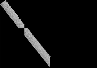
OutputTransparentColor parameter configured with “no color” 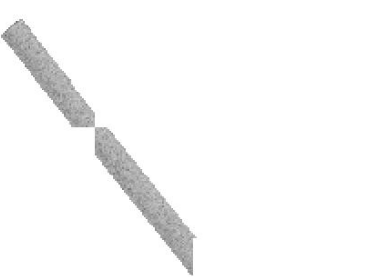
OutputTransparentColor parameter configured with “nodata” color |
SORTING |
Controls the order in which the granules are passed to the mosaic operation. Only useful if MergeBehavior is set to |
SUGGESTED_TILE_SIZE |
Controls the tile size of the input granules as well as the tile size of the output mosaic. It consists of two positive integers separated by a comma. Default is |
USE_JAI_IMAGEREAD |
Controls the low-level mechanism used to read the granules. If set to Note Deferred loading consumes less memory since it uses a streaming approach to only load into memory the data immediately needed for processing, but may cause problems under heavy load since it keeps the granule files open for a long time. Immediate loading consumes more memory since it loads the requested mosaic into memory all at once, but usually performs faster and prevents the “too many files open” error conditions that can occur with deferred loading. |
Continue on with the ImageMosaic tutorial to learn more and see examples.