Mapping services
Mapping services are responsible visualization of your published spatial information, data access and download services, processing and more!
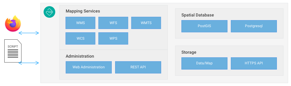 GeoCat Live Mapping Services
Mapping services are intended for machine to machine communication. These services intended to be used from the comforts of a Desktop GIS, or incorporated as part of a mobile apps or web mapping application.
The map viewer included as part of the catalogue service can be used to interact with mapping services and published data.
Mapping and data services are provided by GeoServer Enterprise.